1
/
of
1
Re-Sourced
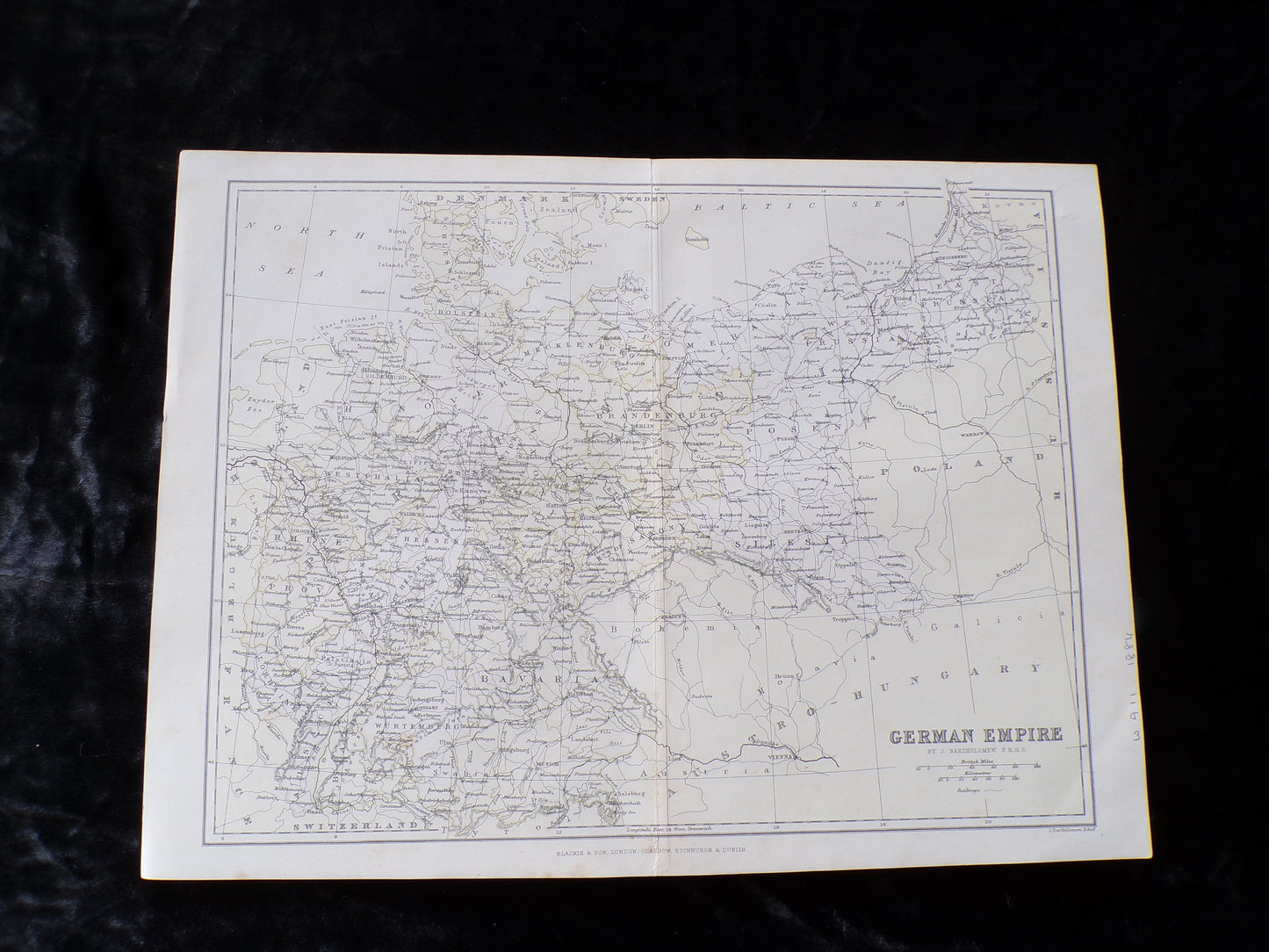
Antique map of the German Empire - 1884 J Bartholomew
Antique map of the German Empire - 1884 J Bartholomew
Regular price
£15.00 GBP
Regular price
Sale price
£15.00 GBP
Taxes included.
Shipping calculated at checkout.
Quantity
Couldn't load pickup availability
Disbound map from the 1884 "Comprehensive Atlas & Geography of the World: Comprising an Extensive Series of Maps, a Description, Physical and Political, of all the Countries of the Earth; a Pronouncing Vocabulary of Geographical Names, and a Copious Index of Geographical Positions. Compiled and Engraved from the Most Authentic Sources, Under the Supervision of W. G. Blackie, PhD., F.S.A.Scot." Sheet number covers Single sheet with horizontal centre fold. Sheet is clean but slightly darkened at the edges. Map is drawn to a given scale with latitude and longitude lines, map is extensively labeled. Pastel shades have been used to denote countries and slightly darker shades have been used to denote boarders. Black and white engraved hatching shows landscape features. Size: 38x56cm. Item Type: Map. No dust jacket, as published. Single sheet map/chart which is suitable for framing. Illustrator: Drawn and Engraved by J. Bartholomew.
Share